
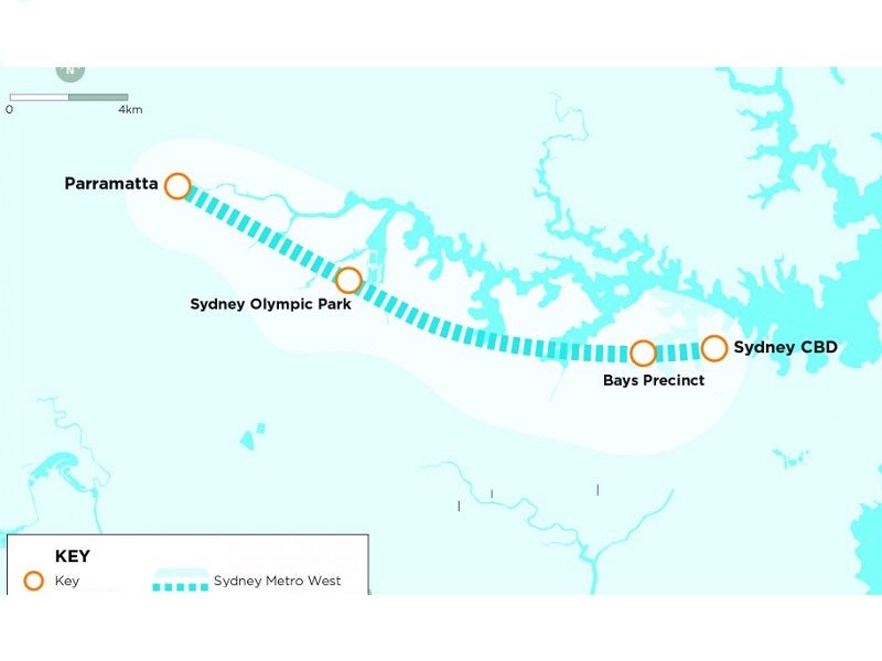
Western Sydney Metro, also known as Sydney Metro West, is a 24km-long underground railway line proposed to connect Sydney central business district (CBD) and Greater Parramatta in Australia.
It is a part of Sydney Metro, the biggest urban rail project in Australia.
Recommended Buyers Guides
New South Wales (NSW) Government announced the Western Sydney Metro underground metro rail project in November 2016. Construction of the metro line is anticipated to be started in 2020, following completion of its final alignment.
The project will involve the construction of two tunnels with a combined length of 24km between Sydney CBD and Westmead. It is estimated to provide service to approximately 3.2 million people living in Western Sydney by 2036.
Commuters will be able to travel from Parramatta to Sydney in just 20 minutes on the new metro rail line. The project is expected to create 10,000 direct and 70,000 indirect jobs.
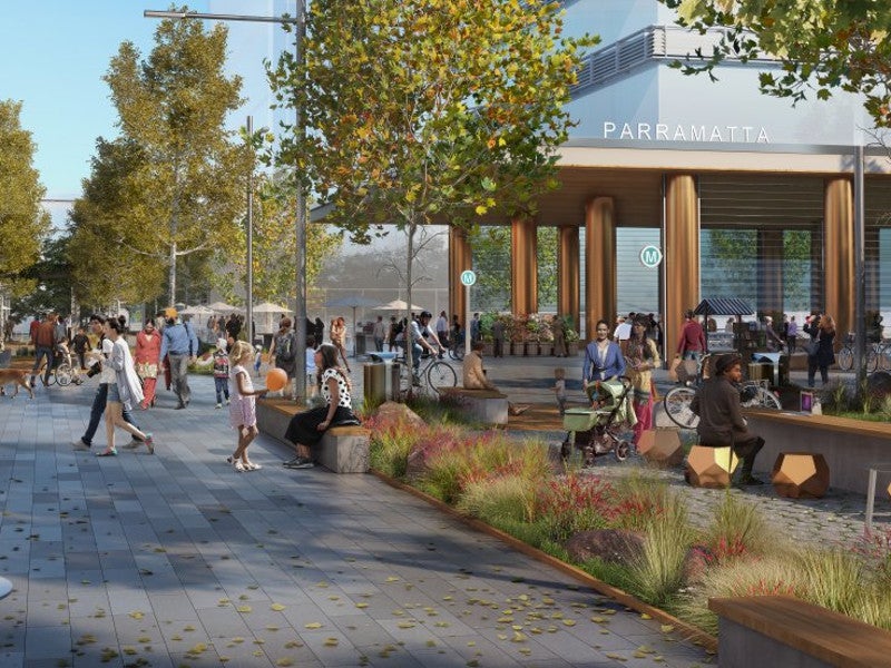
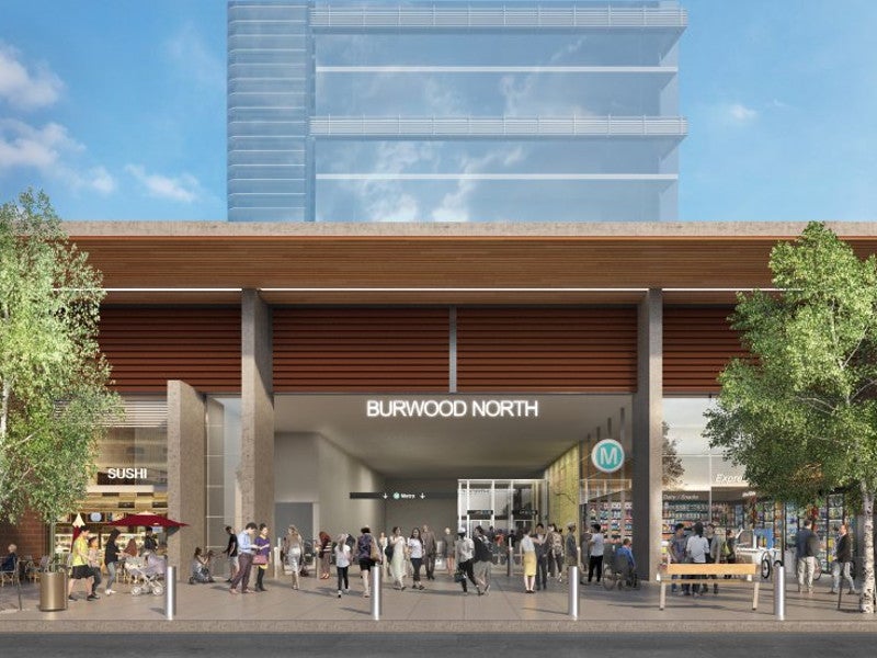
The seven new stations to be built for the Western Sydney Metro include Sydney Olympic Park, Burwood North, Parramatta, Five Dock, Westmead and Bays Precinct. Proposals also include Rydalmere and Pyrmont as strategic station options.
Western Sydney Metro features
The new mass rapid transit system will provide faster and regular access to major employment and education centres such as Parramatta, Sydney Olympic Park, and The Bays. The station at Westmead will provide access to the biggest healthcare and education precinct in Australia. The Sydney West metro will provide rail services to Burwood North and Five Dock.
Metro trains will be fully air-conditioned while stations will be equipped with Opal ticketing system. The metro stations will be integrated with the other public transport systems across Sydney. Commuters can access platforms using lifts and level access between trains and platforms.
Each platform will feature screen doors to keep people and objects away from the edge of the platform. It will also help the trains to enter and exit the stations more quickly. The entire metro system will be under continuous surveillance by the metro operations control centre.
Sydney Metro West station details
The new station at Westmead will be situated on the east of Hawkesbury Road, which is located on the southern portion of the existing Westmead station. The Parramatta station will be situated on the zone closer to the George, Macquarie, Church, and Smith streets.
The Sydney Olympic Park station will be situated at the south of the existing Olympic Boulevard at the Olympic Park station. The main entrances to the station will be located between Figtree Drive and Herb Elliot Avenues.
The new metro station at North Strathfield will be located close to the existing North Strathfield station and can be accessed from Queen Street.
Commuters can access the new Burwood North station from both the north and south sides of Parramatta Road. The station will be located at the junction of Burwood and Parramatta roads.
To be built between White Bay Power Station and GlebeIsland, the new Bays station can be accessed from the south of White Bay. Commuters can directly access the future Bays Waterfront Promenade from the station.
Western Sydney Metro construction details
Initial construction work in Bays Precinct will include investigations, site surveys, and early works for the tunnels.
Tunnel boring machines will be launched from The Bays and Westmead sites to create tunnel sections.
Western Sydney Metro rolling stock
Each metro train of the Western Sydney Metro system will feature two multi-purpose zones for baggage, bicycles and prams. Separate space will be provided for wheelchairs, priority seating and emergency intercoms.
Vehicles will also be equipped with real-time journey information systems and live electronic route maps.